Business Fields
We create, develop and support your needs with our services and applications. We create unique experiences.
Customized solutions
We meet your needs, create solutions and develop unique applications.
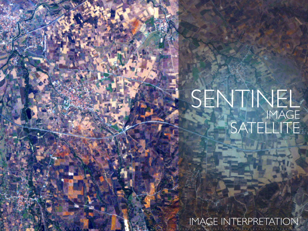
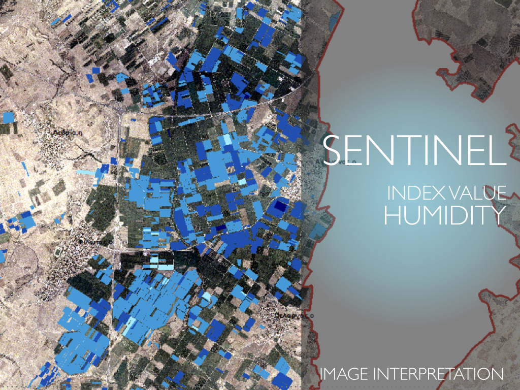
Monitoring the environment to support its protection is the main aim of the EU Copernicus satellite program.
Usually, satellite-derived information has mostly been technology-driven and consequently, there is limited awareness among cross-cutting sectors on the range of applicable solutions, their access and affordability for evidence gathering on environmental issues.
We aim to bridge the gap by utilizing the Satellite acquire data to respond to the demands for ready-to-access evidence and scenario information on environmental situations.
A profound example concerns the legal/jurisdictional sector, where our Earth observation-based tools and services provide evidence on environmental incidents and legal violations to support the evidence data-gathering process and to foster data-driven decision-making.
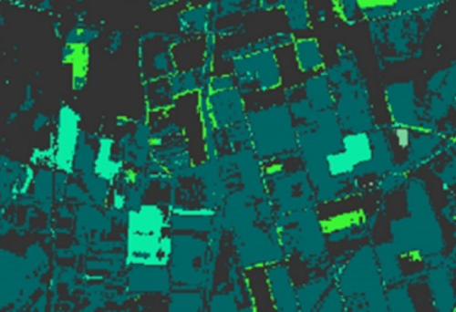 Random Forrest Classification
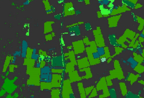 Μaximum Likelihood Classification
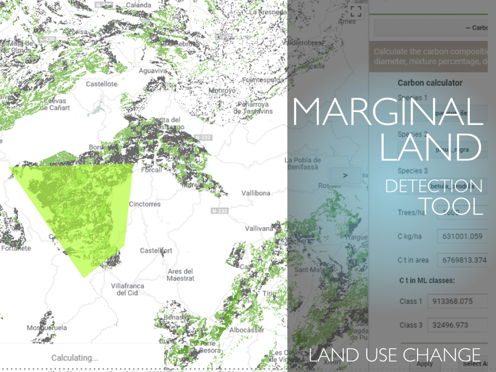
Another example concerns the energy/environmental sector, where our Marginal Lands detection and clustering tools could offer suitable carbon sinks
by afforestation/reforestation projects without being competitive to food production, conforming to EU/Global policies. An effective mitigation strategy should assess all the possible sustainable actions that can contribute to this direction.
A challenging and very prominent contribution to raise CO2 sequestration could come from the Land Use Land Use Change and Forestry sector and the utilization of Marginal Lands that today are widely available in the EU.
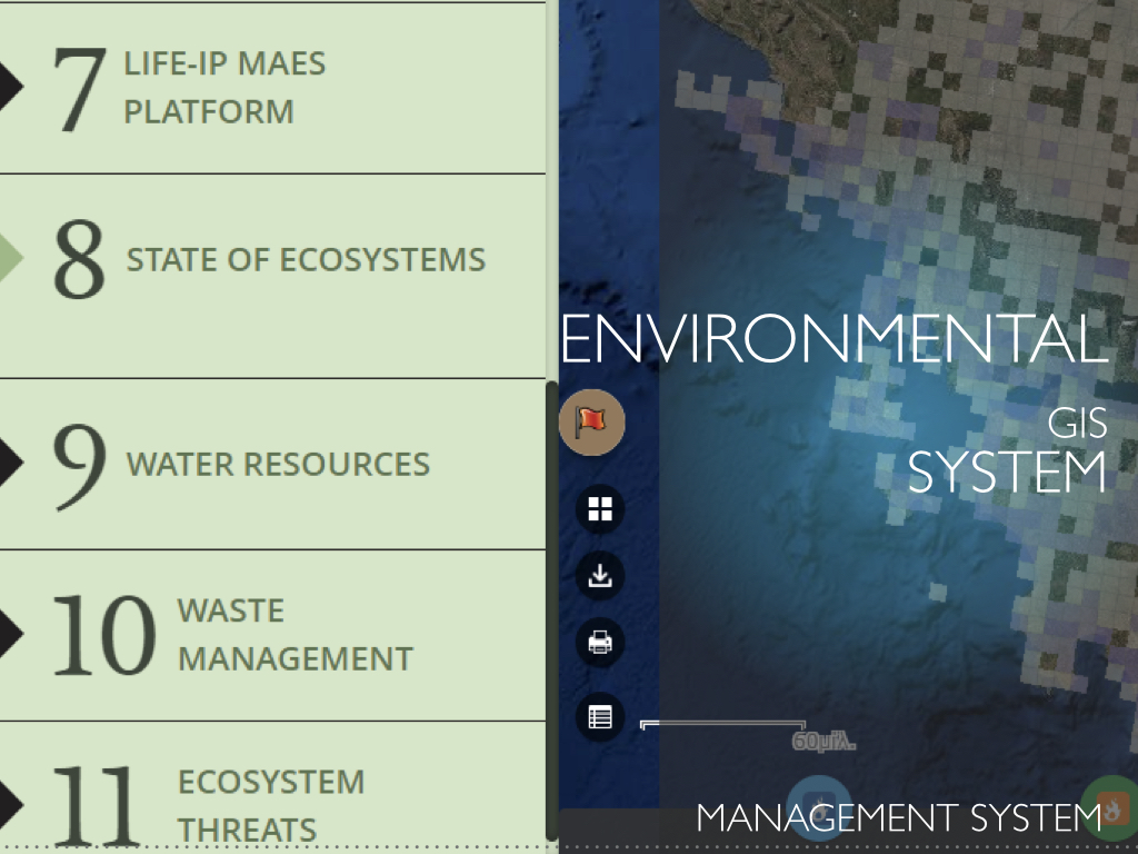
Monitoring of the urban and peri-urban green and the threats and pressures
faced to the biodiversity from anthropogenic and natural causes directly addresses the ecology/environment sector needs. Our developed smart tools and the Biodiversity Information System utilize Earth observation data, in-situ sensors, citizen science and Geographic Information analysis tools.
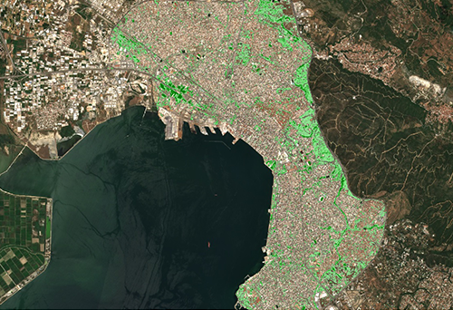 Ratio of Green area
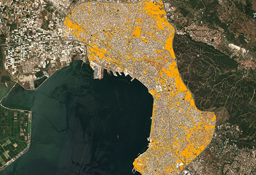 Ratio of Permeable area
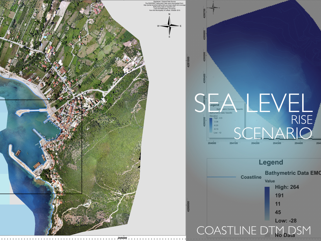
We support the civil protection sector by developing satellite/UAV based and GIS risk assessments,
improving governance and raising community awareness towards the impacts of natural disasters caused by combined effects of sea level rise and land subsidence in coastal zones.
We have also developed tools which utilize satellite imagery for crop mapping
and accurate calculation of available biomass to achieve optimal supply chain and cost reduction. These directly respond to the need of green energy sector.
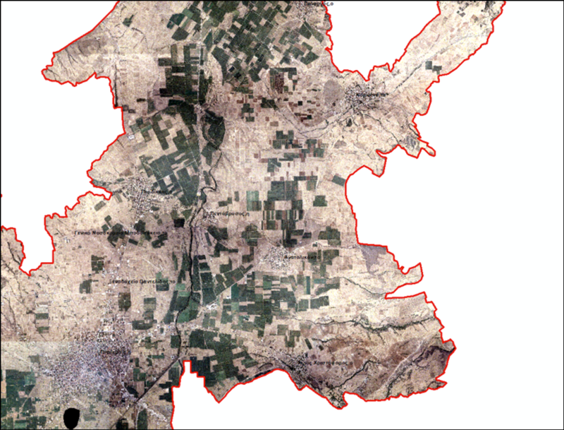 Land slope of the plots
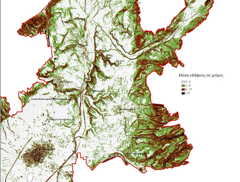 Calculation of land slope of the plots
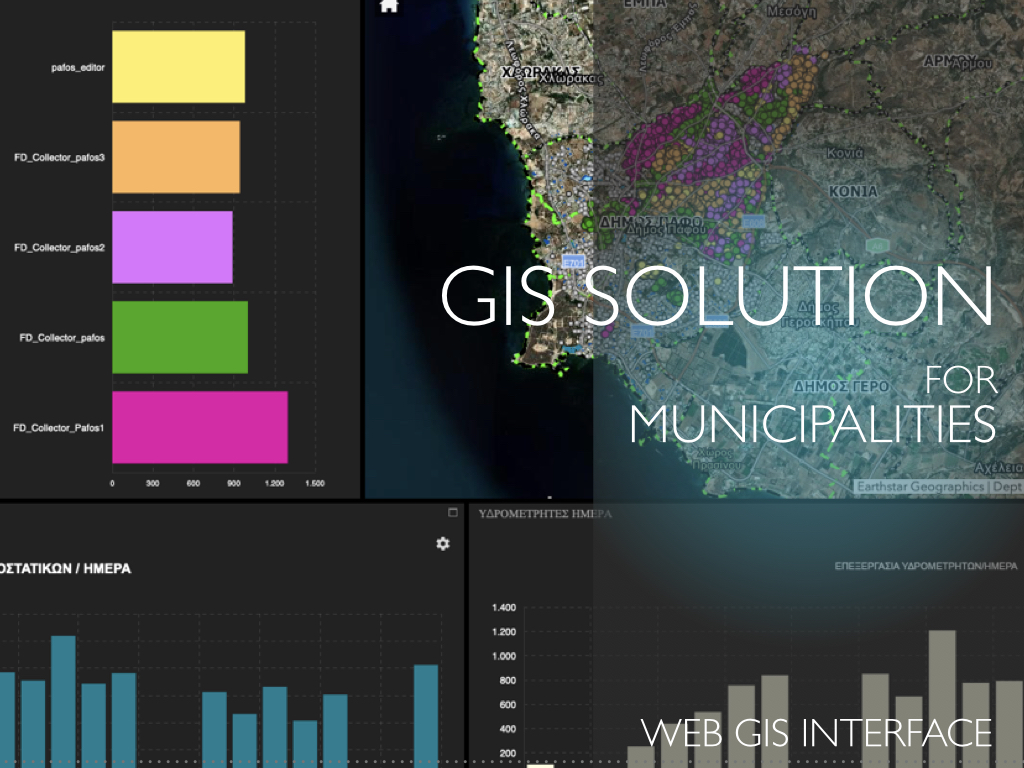
GIS is a multidisciplinary field that encompasses a wide range of services and applications across various industries.
The technology and tools to maintain organize and analyze information with spatial reference are focused on building and maintaining Geographic Information Systems (GIS)
In this context, we have the experience to acquire user needs, assemble the user requirements, design the geospatial databases, and design and implement the required user interfaces to meet the user requirements.
In addition, we provide training for specialized and non-specialized users as well as support for the systems we have implemented with the aim of providing comprehensive GIS services.
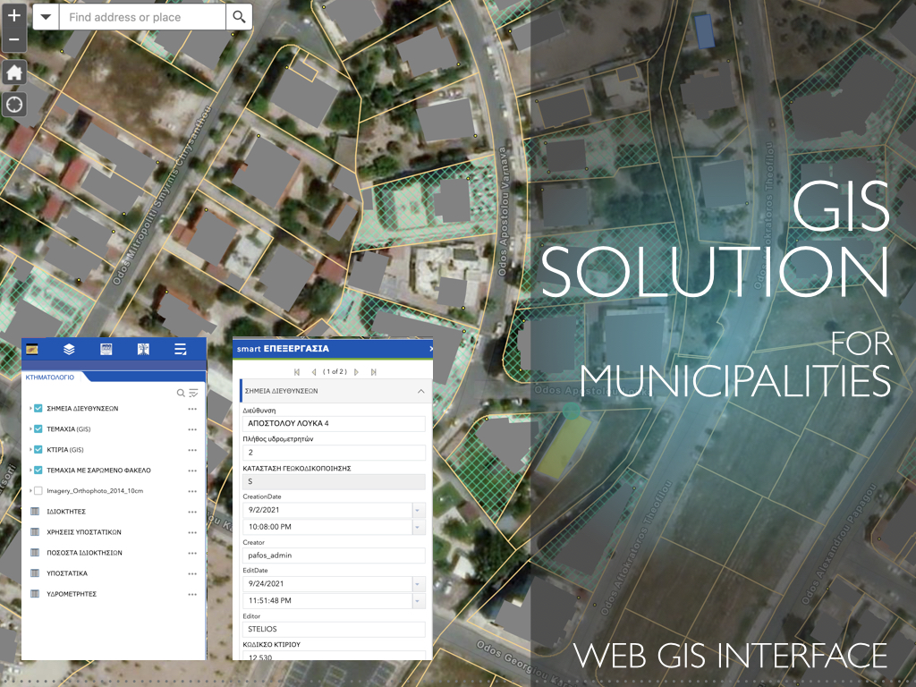
KIKLO designed and developed a Unified GIS Solution for Municipalities
that integrates database infrastructure with migration and automation tools and user interfaces to manage the daily, biweekly, and monthly processes of the departments such as Technical Services, Economic department, Citizens Service Office, Green Service, Cleaning Service, Traffic law Service etc.
The tools that were implemented provide the end-user the ability to update and maintain data using a Web GIS Interface and mobile GIS applications.
Spatial Analysis involves various techniques
such as proximity analysis, overlay analysis, and spatial modeling to understand patterns and relationships in geographical data.
In this context we have used the GIS for
environmental management, managing natural resources, tracking environmental changes, and assessing human activities on the environment. Furthermore, in the field of disaster management GIS is used for disaster preparedness, response, and recovery. It helps in identifying vulnerable areas, managing resources during emergencies, and assessing damage post-disaster.
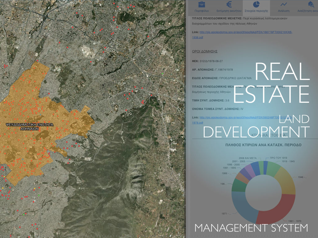
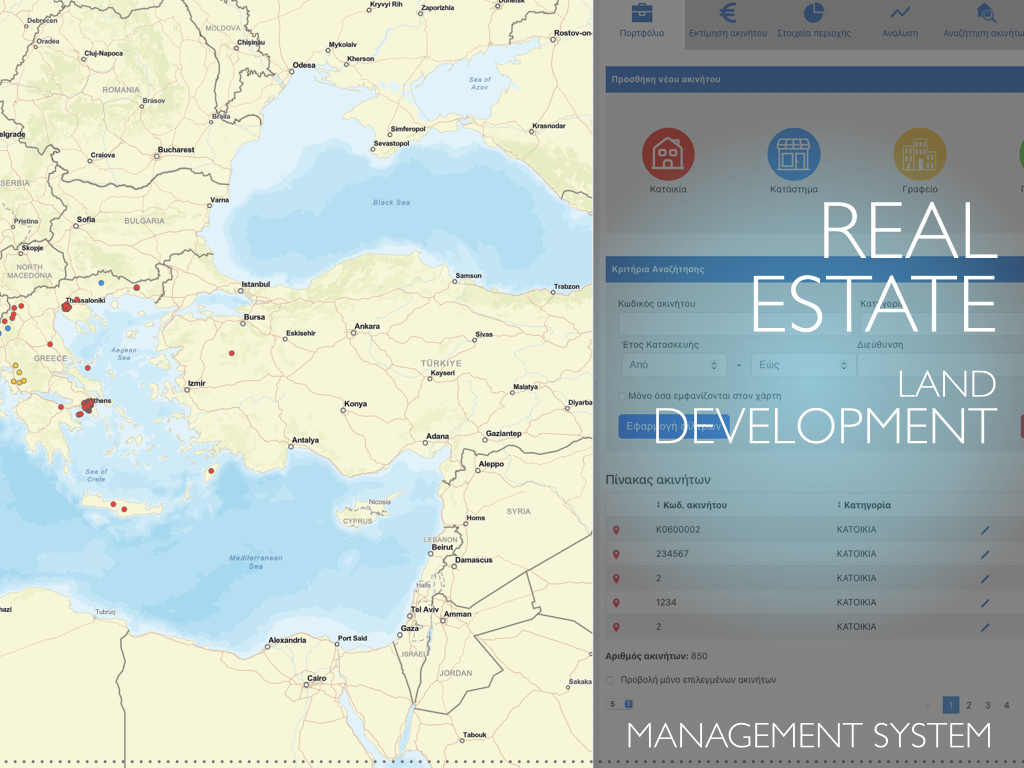
In the sector of Real Estate a GIS system is used for
site selection, property valuation, and land development planning. It helps in identifying investment opportunities and managing property portfolios.
We have designed and implemented GIS systems for
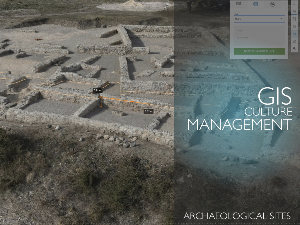
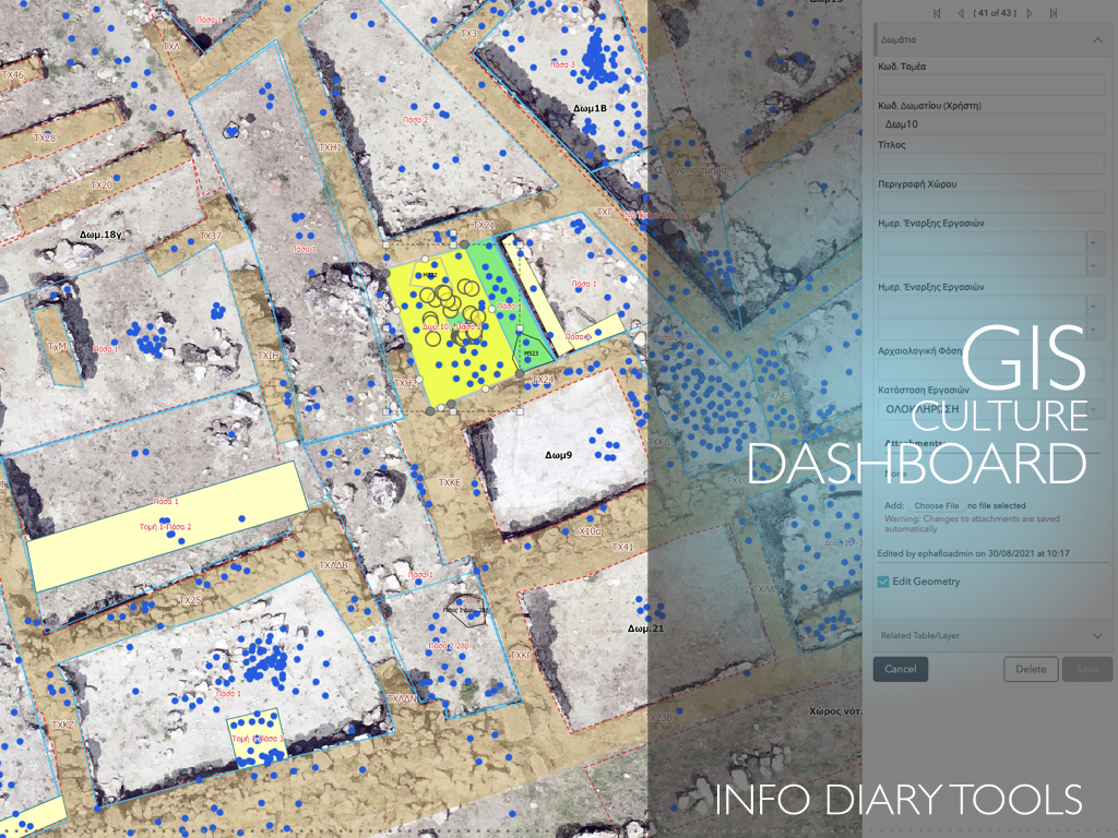
Archaeology and Cultural Heritage to support archaeologists to record, analyze, and manage archaeological sites and cultural heritage data. The developed WebGIS applications and a portal provide information to the public in addition to specialized users.
All the collected data from the excavation are integrated into the web portal and a virtual tour displays the site online.
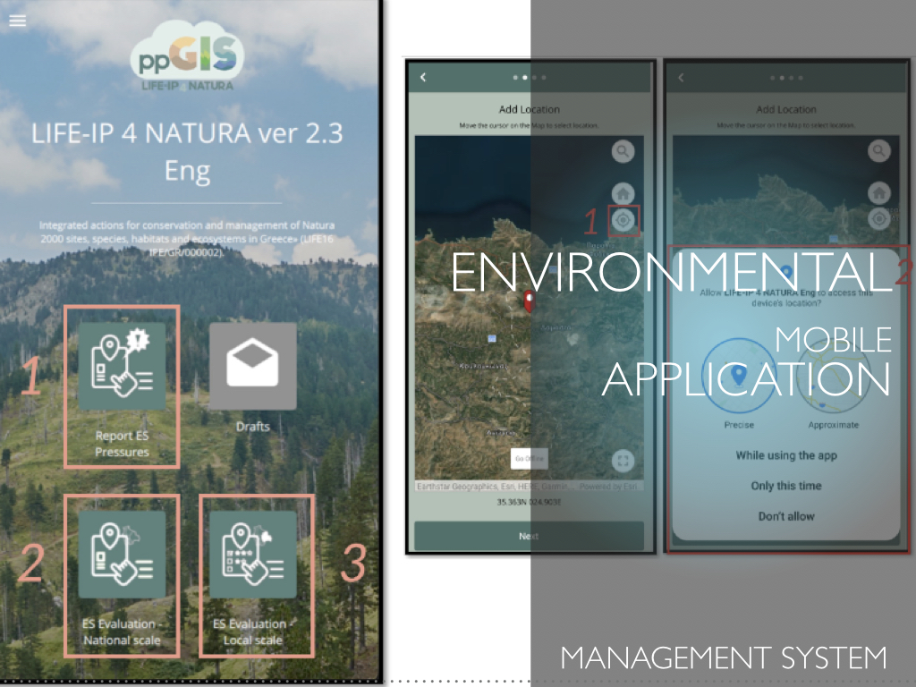
KIKLO designs and develops mobile applications using indoor/outdoor positioning technologies
and the corresponding event management and monitoring applications. In this context, a mobile application for sending events and/or requests was developed so that users can share their location in a central Geographic infrastructure.
The aim is for the competent agency to take the location of the incident and initiate the necessary actions.
The implemented solution is based on GIS infrastructure, using the positioning capabilities of mobile devices (tablets or mobile phones) outdoors and Wi-Fi fingerprinting technology to determine the location of the event indoor.
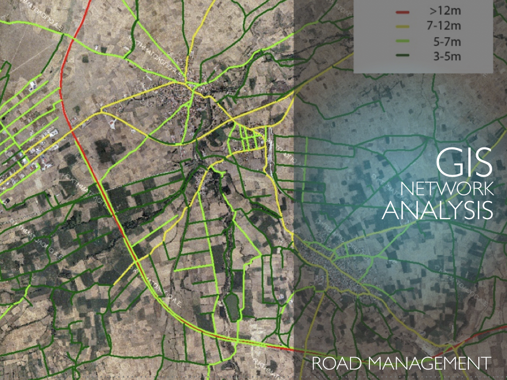
The Network Analysis field is based on designing, optimizing, and serving routes and service allocation areas.
We have used our expertise in the field of Transportation Planning to analyze transportation networks and optimize routes. In addition, GIS is the main tool for Utility and Infrastructure Management, such as water and sewer networks aiming in maintenance, asset tracking, and service provision.
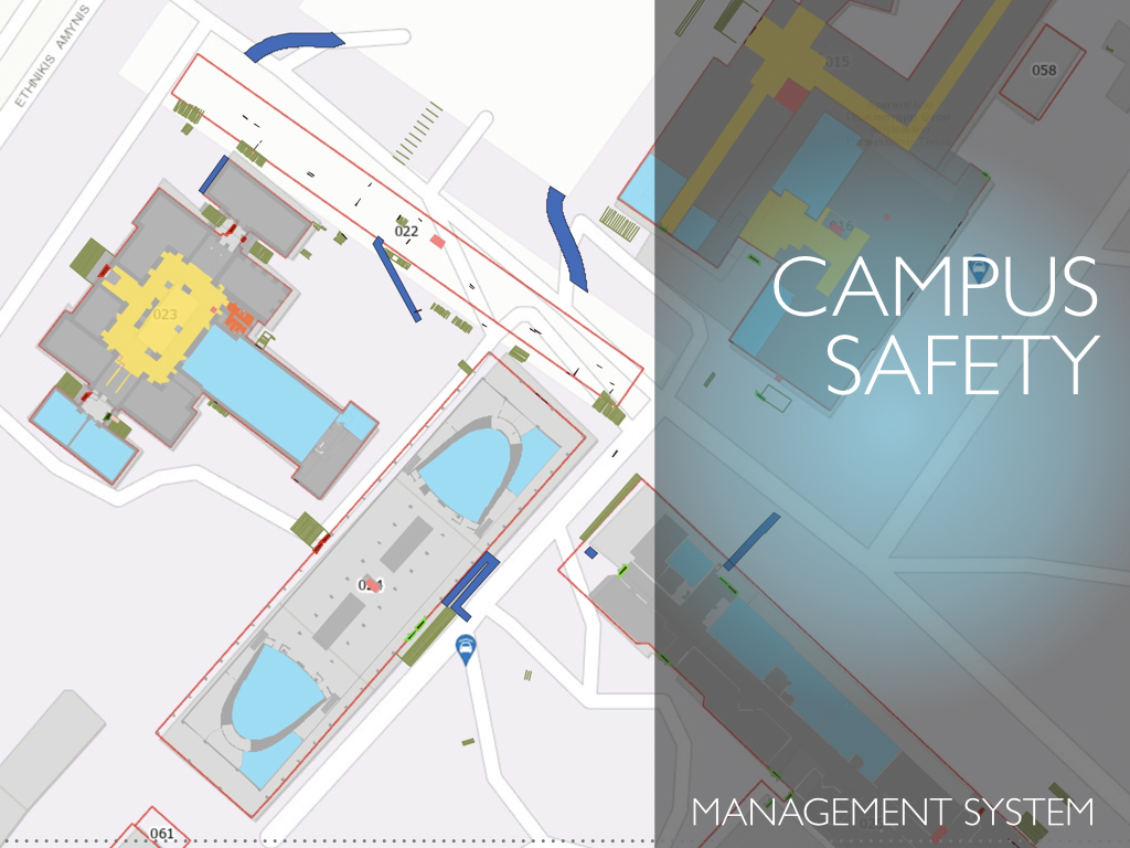
Indoor and outdoor movements patterns and routing services are also our expertise to support disabled persons’ access.
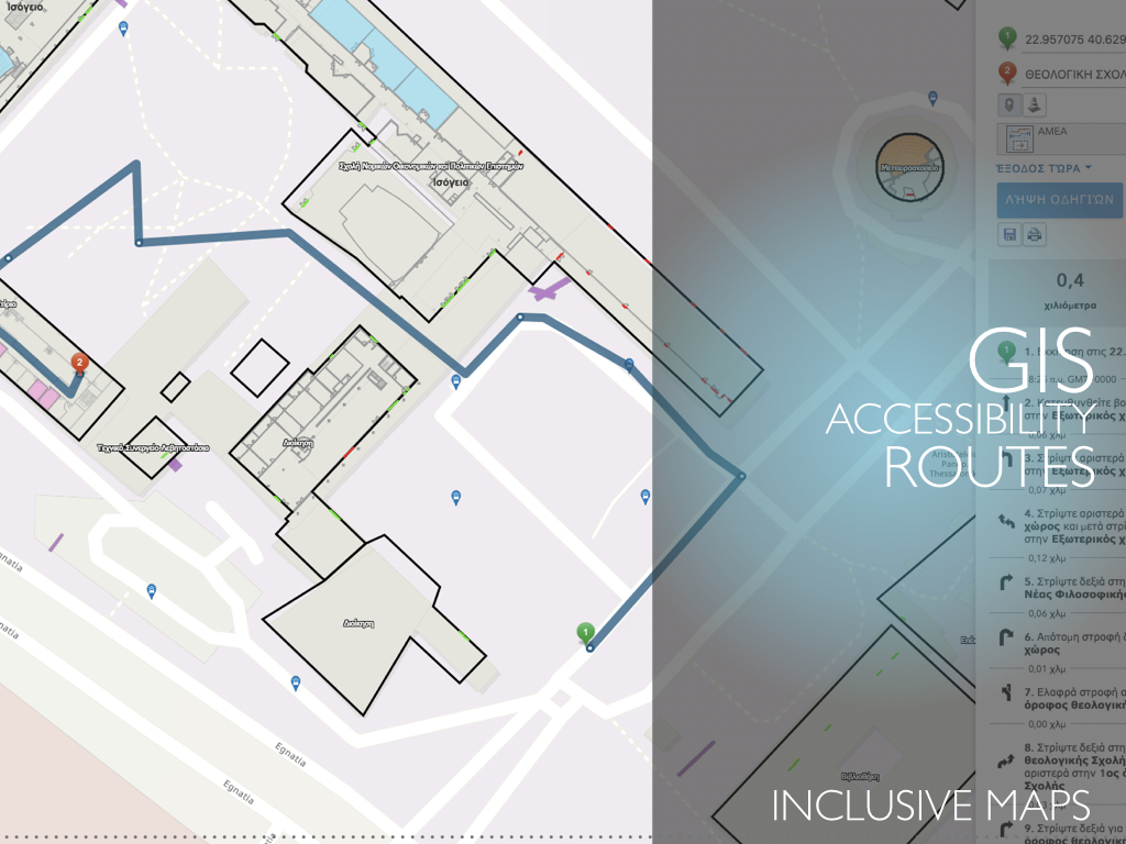
A routing application for people with disabilities
aims at providing online the location of a place (e.g. a classroom), search for the best route to it by setting a starting point and of course search for other auxiliary spaces and the routes to them.
The application was implemented and configured to provide search for spaces on university campuses and routing to them.
The above-described applications consist of components
that can be used to build multi-variant optimization tools for optimizing supply chain operations, while considering multiple variables and factors.
Such tools can provide to the retailers the ability to select the best locations for new stores and distribution centers, optimizing inventory placement and delivery routes, to the manufacturers to choose raw materials efficiently, choose manufacturing plant locations, and optimize distribution networks and to the logistics companies the tools for route planning, fleet management, and real-time tracking to ensure on-time deliveries.
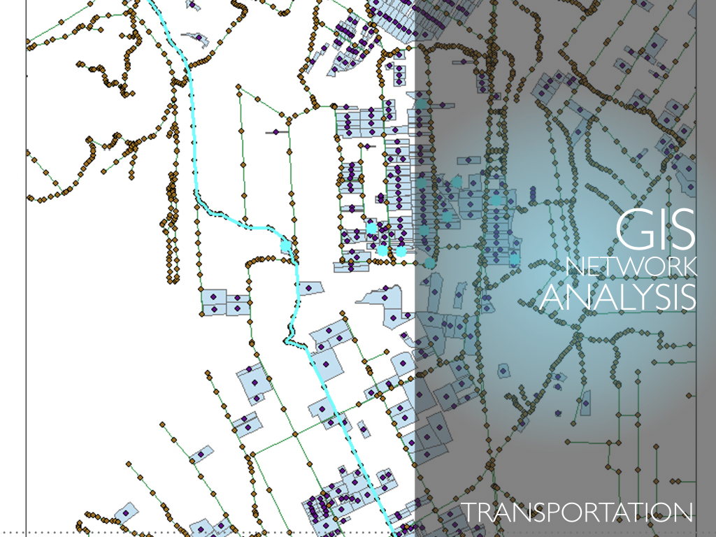
Advancements in sensors and processing techniques have revolutionized data acquisition and products
in the field of 3D mapping and modelling at various scales. Structure from Motion algorithms and high-resolution imaging sensors can produce highly accurate and ultra-high resolution 3D point clouds.
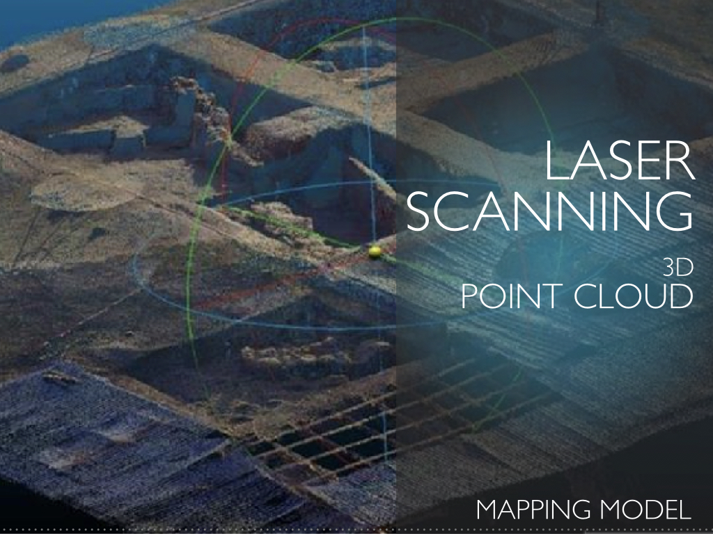
On the other hand, terrestrial laser scanners, miniaturized Lidar sensors and SLAM devices are also acquiring highly accurate and ultra-high resolution point clouds. These advancements have led to the creation of huge datasets that need novel approaches for big data management & processing.
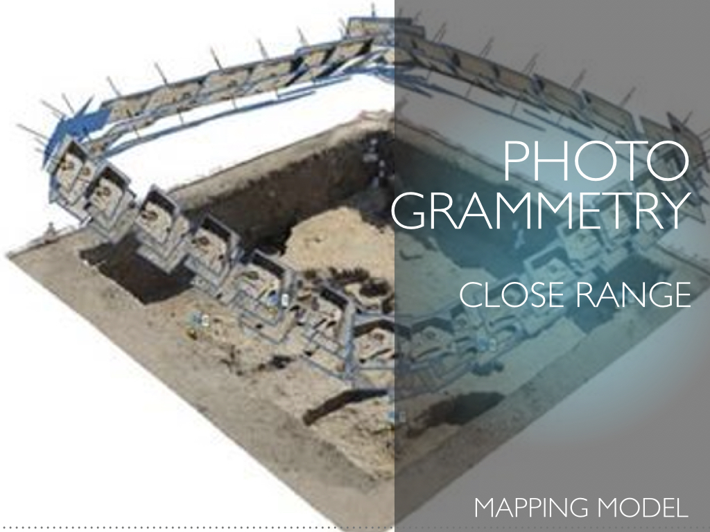
We have developed algorithms, workflows, and data acquisition procedures
that enable us to process and analyze close range and aerial imagery at various scales in an efficient way. We offer integrated solutions including data acquisition planning, multi spectral imagery analysis and production of Digital Elevation / Surface models, orthoimages, 3D models, classification products, and VR models.
Our solutions cover different applications such as mapping, cadaster, cultural heritage, medical, 3D modelling, etc.
We have access to a series of UAV platforms including
fixed wing, multi-rotor and hybrid vertical take-off and landing that are equipped with optical, multi-spectral and Lidar sensors. Our integrated solutions provide mission planning, data acquisition, processing and analysis, and the creation of products such as 3D models, Digital Elevation / Surface models, orthoimages, classification images for different application fields. We have provided services for cadastre, cultural heritage, forest mapping and agricultural applications.
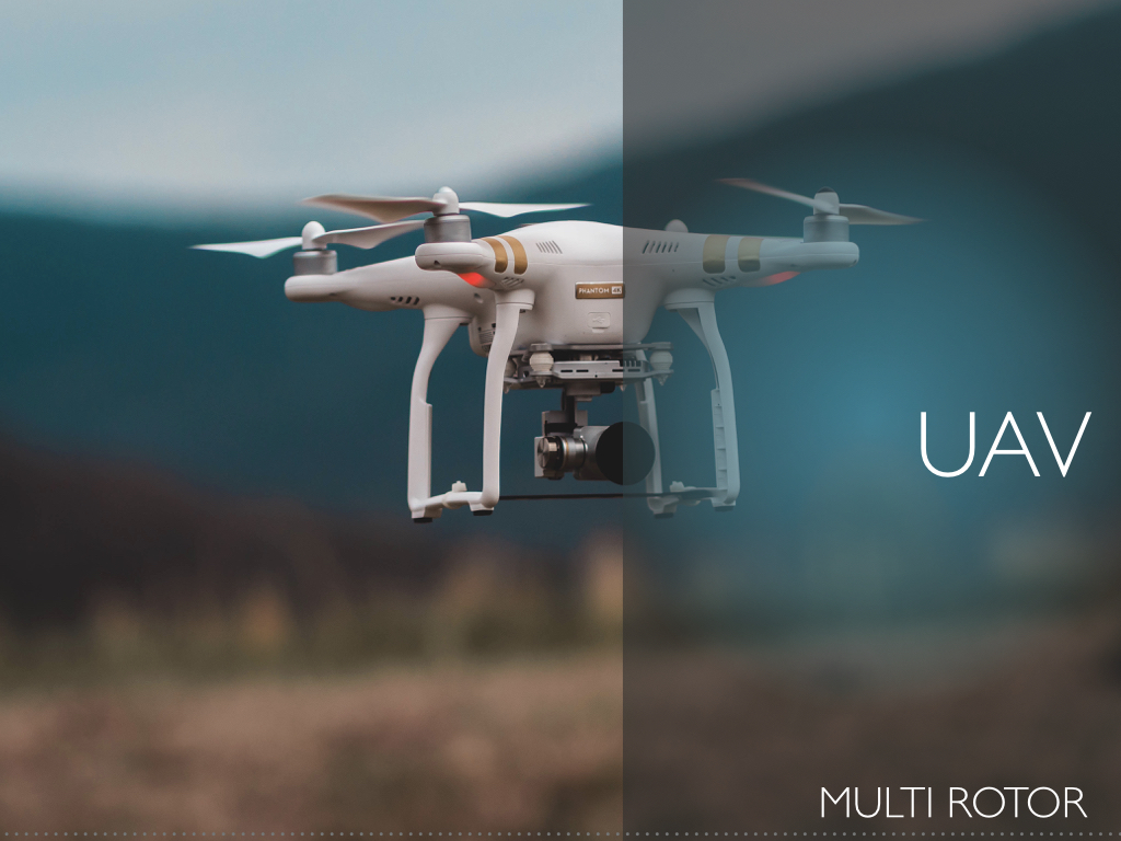
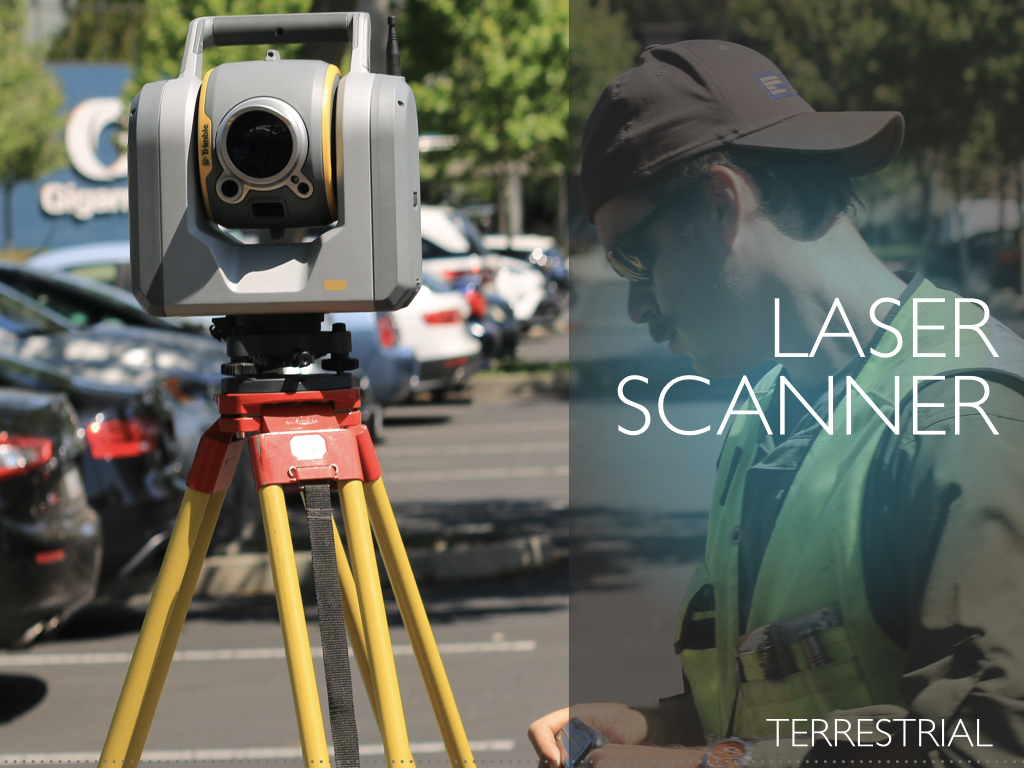
Our laser scanner data acquisition and processing capabilities span from
triangulation laser scanners (for the 3D modelling of small objects), and SLAM devices to middle- and high-range terrestrial laser scanners. We offer integrated data acquisition and processing solutions to produce highly accurate and ultra-high resolution 3D models in the application fields of cultural heritage, archaeology, BIM, indoor and outdoor building mapping, and 3D modelling, medicine, and critical infrastructure monitoring.
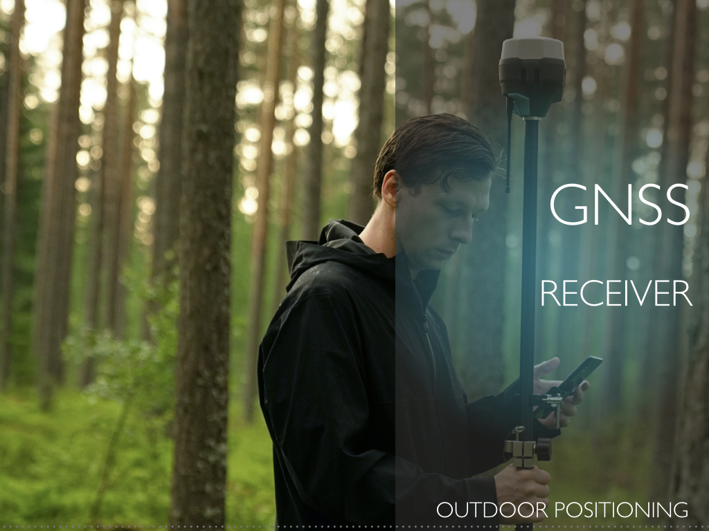
The evolution of Global Navigation Satellite Systems (GNSSs)
has already shown the wide range of applications that can be used and the revolutionary impact that has brought on positioning performance.
Presently, low–cost GNSS receivers have been designed primarily for industrial tracking and wearable applications and are used in everyday life and everywhere: in our pockets, our toys, our smart devices, our infrastructure, and our factories.
New generation multi-constellation, multi-band, low-cost receivers,
boost GNSS receiver performance, bringing scalable and affordable high precision positioning to the mass market. The addition of Galileo and BeiDou to GPS and GLONASS not only extends GNSS positioning to more obstructed environments, but also allows the use of new era.
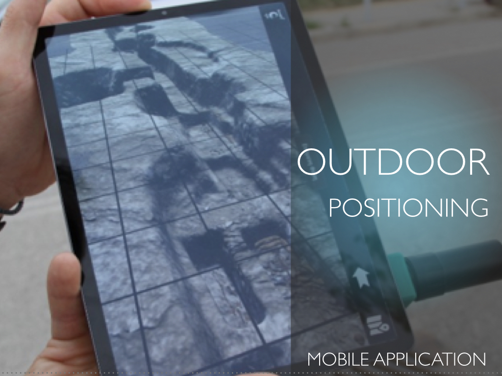
KIKLO has developed custom accurate outdoor positioning devices based on u-Blox.
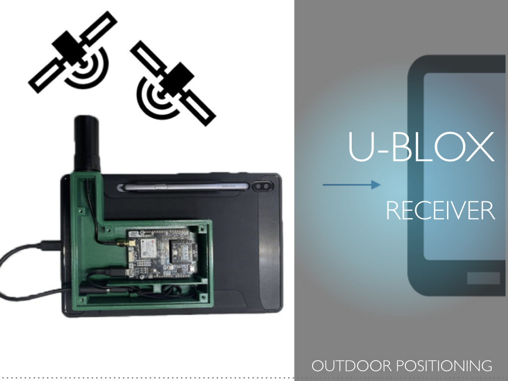
On the other hand, current paradigm shifts to Human-Centered well-being
for the Aging population, personalized Well-being scenarios and daily activities, as well as Occupational Safety and Health at work and outside, to support later retirement of older adults.
These challenges call for development of real-time Indoor and Outdoor Positioning and Monitoring technologies paired with Artificial Intelligence.
The trend is that technical enablers become cheap, wireless communication reliable and embedded devices less resource hungry.
Mainly driven through the advent of IoT this trend has even been increased, supporting technical solutions for real-time monitoring, event persistence in Big Data pools and smart algorithms which allow the digestion of large data collections and the generation of critical insights.
For the Outdoor positioning the smartphone technology and GNSS are combined.
Almost every person has today a smartphone in their pocket, which is not only used to call other people but also to share their location on social networks or to plan activities. Our smartphone tools compute a person’s position using the device's sensors, such as accelerometers, gyroscopes and magnetometers, proximity sensors, and GPS/GNSS chipset.
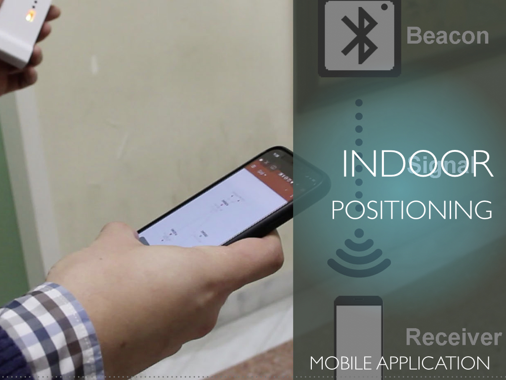
Our Indoor positioning technology is based on a high precision Real Time Location Tracking System (RTLTS) using Ultra Wide Band Beacons and customized sophisticated positioning software algorithms. In addition to this unique capability, Ultra-Wide Band can offer data communication while using extremely low energy – enabling coin cell operation for years without needing to be recharged or replaced.
This approach aims to compensate for lack of precision, or failure of GPS and other satellite technologies as in the case of e.g. inside multistory buildings, airports, manufacturing industries, large corporate areas, university campuses, etc.
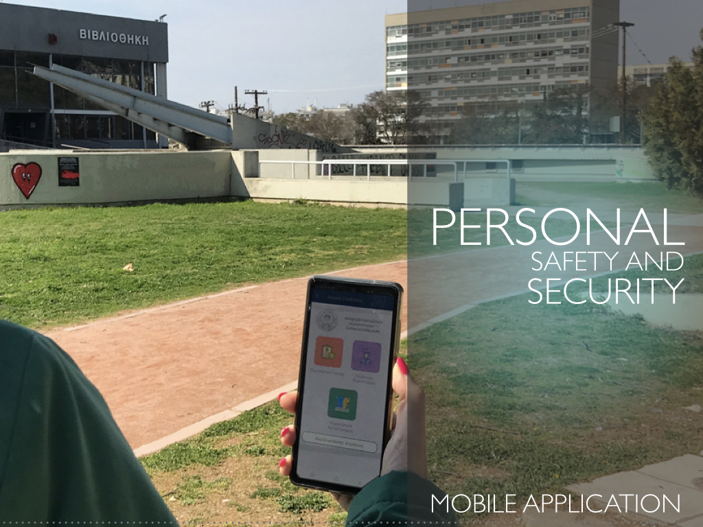
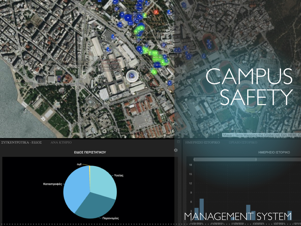
Personal Safety and Security in such populated areas, is based on alerting and real-time managing several security incidents.
Such areas consist of both open spaces, where mobile phone GPS technology easily provides the incident’s location, as well as built infrastructure, where indoor position calculation must be based on other technologies. We further developed our RTLTS system to support indoor localization via Wi-Fi fingerprinting technology, as well as developed our Mobile API and a web GIS Management System based on:
- (a) GPS technology for outdoor positioning,
- (b) Indoor localization technology,
- (c) GIS Technology to manage the spatial incident information,
- (d) a GDPR and user authentication system,
- (e) an alert management protocol and
- (g) a dashboard function for overall statistics analysis.
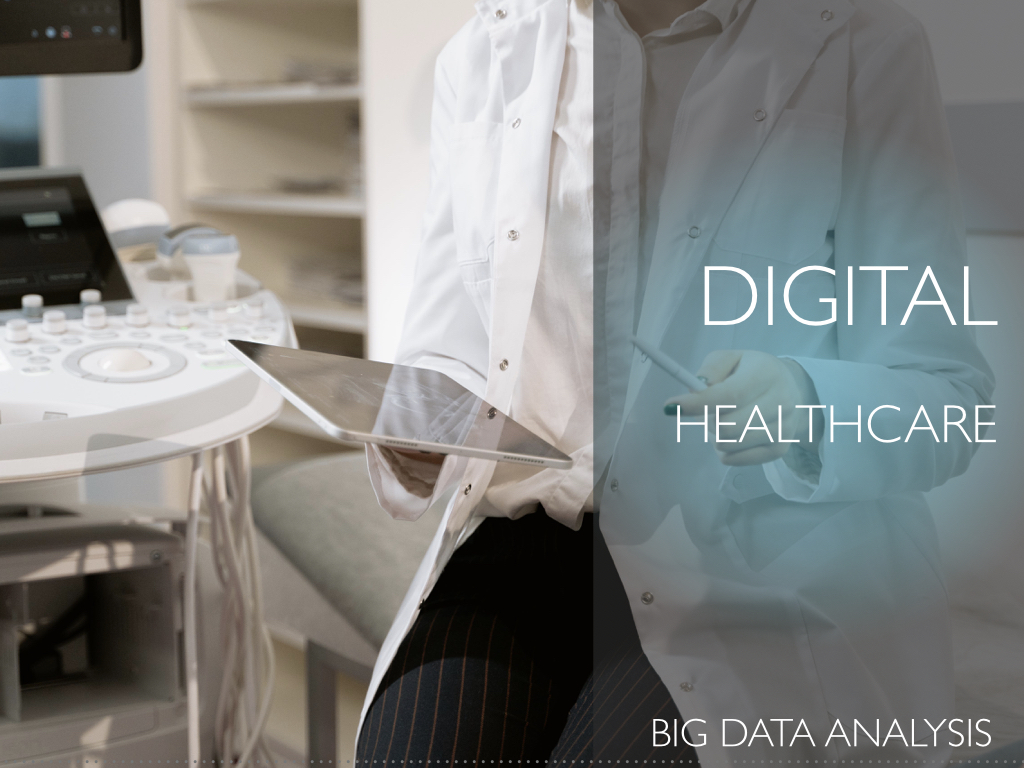
The increasing presence of Digital Healthcare Data and the use of big data analysis
have the potential to create a breakthrough but also face major data issues: lack of interoperability, various formats, various ontologies/typologies, incomplete or erroneous data, country and population biases, regulatory challenges in implementation, etc.
We develop tools to:
-
1
Exploit and extend
the Observational Health Data Sciences and Informatics (OHDSI) and Observational Medical Outcomes Partnership (OMOP) Common Data Model (CDM)
-
2
Standardize and structure,
content, and semantics of health data
-
3
Map health records
to current standard open data models, ie. European Health Data and Evidence Network (EHDEN).
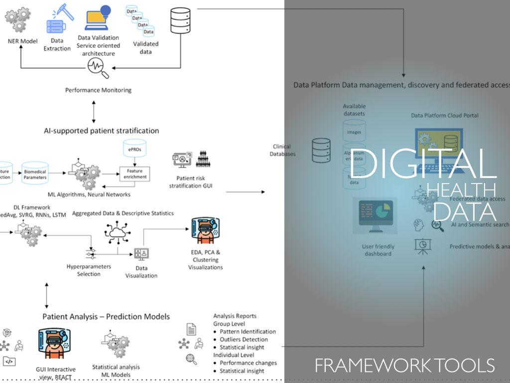

Patient stratification and outcomes assessments hold prominent places in shared decision making in Medicine.
While patient risk stratification aims to assess disease progression and support treatment choice, health outcome assessments help to determine the efficacy of the therapies prescribed.
We develop ML/AI tools for patient stratification. In addition, we use Federated Learning to develop a distributed framework able to analyze structured medical data.
Augmented Reality (AR) is a visualization technique that superimposes computer generated data,
such as text, video, audio files, graphics, animations, 3D models, drawings, maps, GPS data, and other multimedia formats, combining real and virtual worlds in 3D while being interactive. Especially, AR can augment one’s view and transform it with the help of a computer or a mobile device and enhance the user’s perception of reality and of the surrounding environment.
AR has undergone considerable improvement in past years. Many special techniques and hardware devices were developed, but the crucial breakthrough came with the spread of intelligent mobile phones. Now, the conditions of critical enablers (powerful mobile devices in combination to fast 4G/5G networks, multi-sensors such as gyroscopes, accelerometers, and TOF lenses, geo-referenced data, 3D tracking, cloud services, etc.) is better then ever.
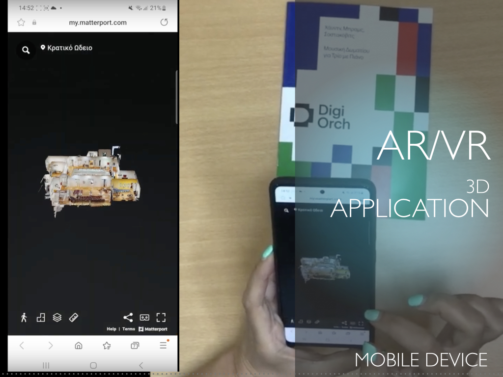
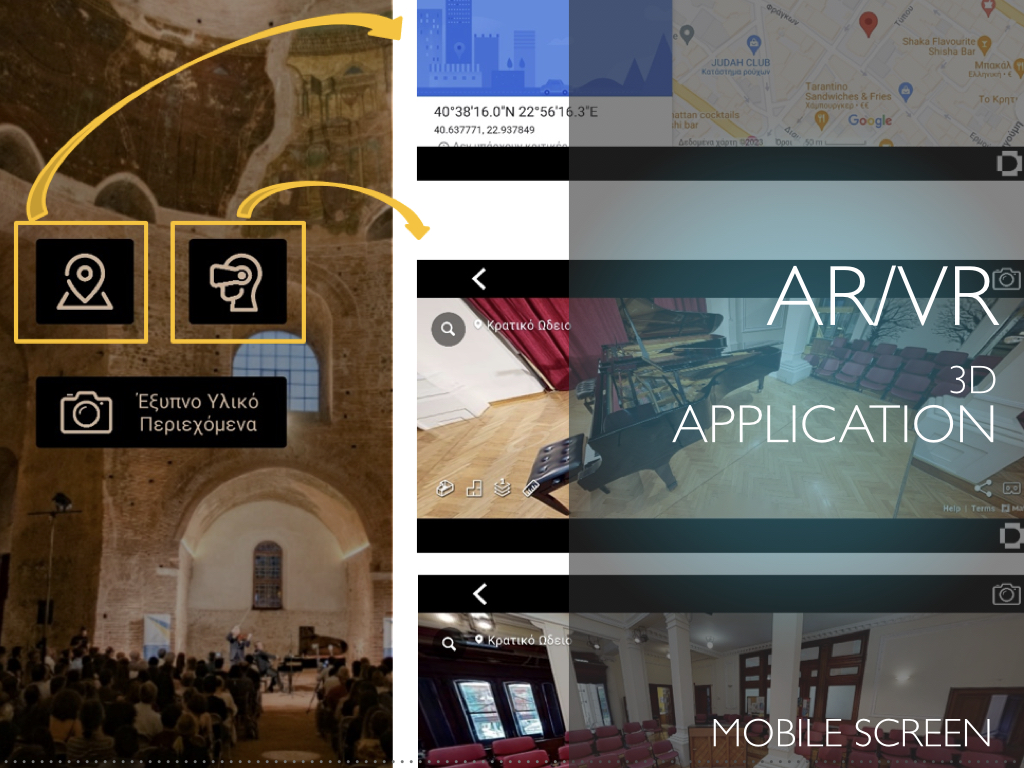
Culture is a privileged field for AR/VR applications,
which allow the user to be guided and receive real-time information. Such developments require the integration of mobile positioning and pose estimation technologies, AR algorithms, GIS and spatial databases, with powerful Content Management Systems (CMS), with functionalities for data storage, management, and serving dynamic information.
We have developed integrated tools for multi-sensor tracking and 3D pose estimation of mobile devices for AR applications. These are enhanced by fully automated CMSs for managing dynamic workflows, in the most time-effective manner, while imposing minimum requirements of the mobile smart devices.
The European Union is managing enormous challenges regarding climate change and energy security
as well as public acceptance, competitiveness, and energy poverty especially in areas that are intensely experiencing the phase-out of coal. Assessing the socio-economic impact of the complex nature of decarbonization and energy transition and developing an effective governance model inevitably leads to development of smart tools, like our Just Energy Transition Observatory (JETO), aiming at designing, hosting, and monitoring evaluation models as well as strong citizen engagement in the governance structure and decision-making processes, to mitigate social, employment, economic and environmental impacts of the transition and support evidence-based and place-based policy making.
On the other hand, the pace of digitalization in the energy sector, compared to other sectors, is still quite slow.
Digitalization provides vast opportunities enabling greater deployment of decentralized renewable energy solutions and taking energy efficiency to the next level. A few worth mentioning key innovations of this enabling sustainable local generation and consumption are the sensors; real-time advanced data analytics; artificial intelligence; blockchain; internet-of-things; web-based and BIM based planning.
Ongoing innovation and digitalization of the energy system is creating new market structures and giving enormous power to consumers.
For example, in electricity markets there is the development of “prosumers” – customers that have invested or are willing to invest in power generation to meet their own energy demand as well as trade the excess energy with power utilities and other consumers connected with the grid. Thus “Energy citizenship” is not limited to early technology adopters and environmental activities and it goes beyond (but also encompasses) mere “consumer involvement”.
On top of our JETO, we also developed tools for monitoring and analyzing vast amounts of data.
Due to the nature of the data (ie. spatial extent, networks/chains, land uses, environmental, social/demographic, economics/employment) big data content analysis tools have been developed. In addition, scenarios and geospatial analysis representation, and visualization/dashboarding tools demonstrate the applicable Renewable Energy Systems potential (solar, wind, biomass etc.). The required spatial analysis for the installation and the distance from roadways and established electricity grids, the characteristics for the required space for given capacity as well as constraints regarding protected areas, are considered.
